|
Page Down to Non-Supplemental Maps & Products Return to Link Page GoTo Bottom for Maps for sale. Click for Map Indexes for sale GoTo Bottom for Pictorials for sale. E - Mail Me
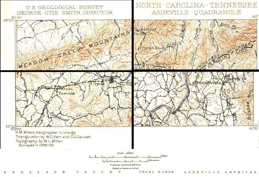
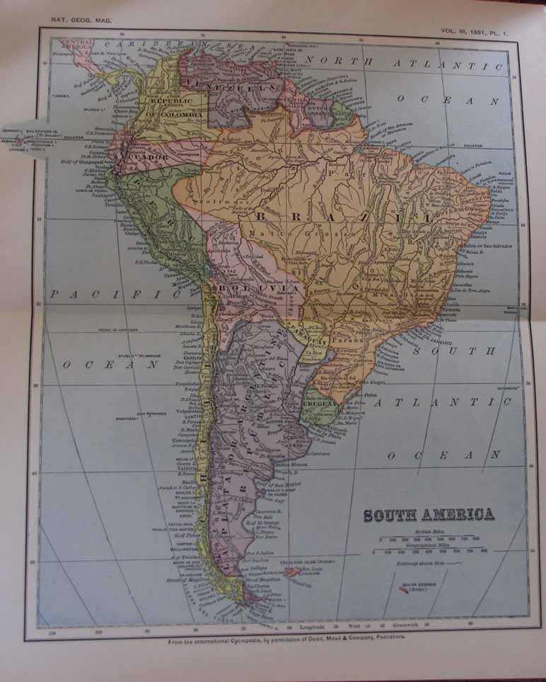
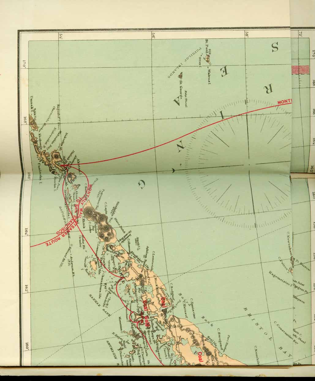
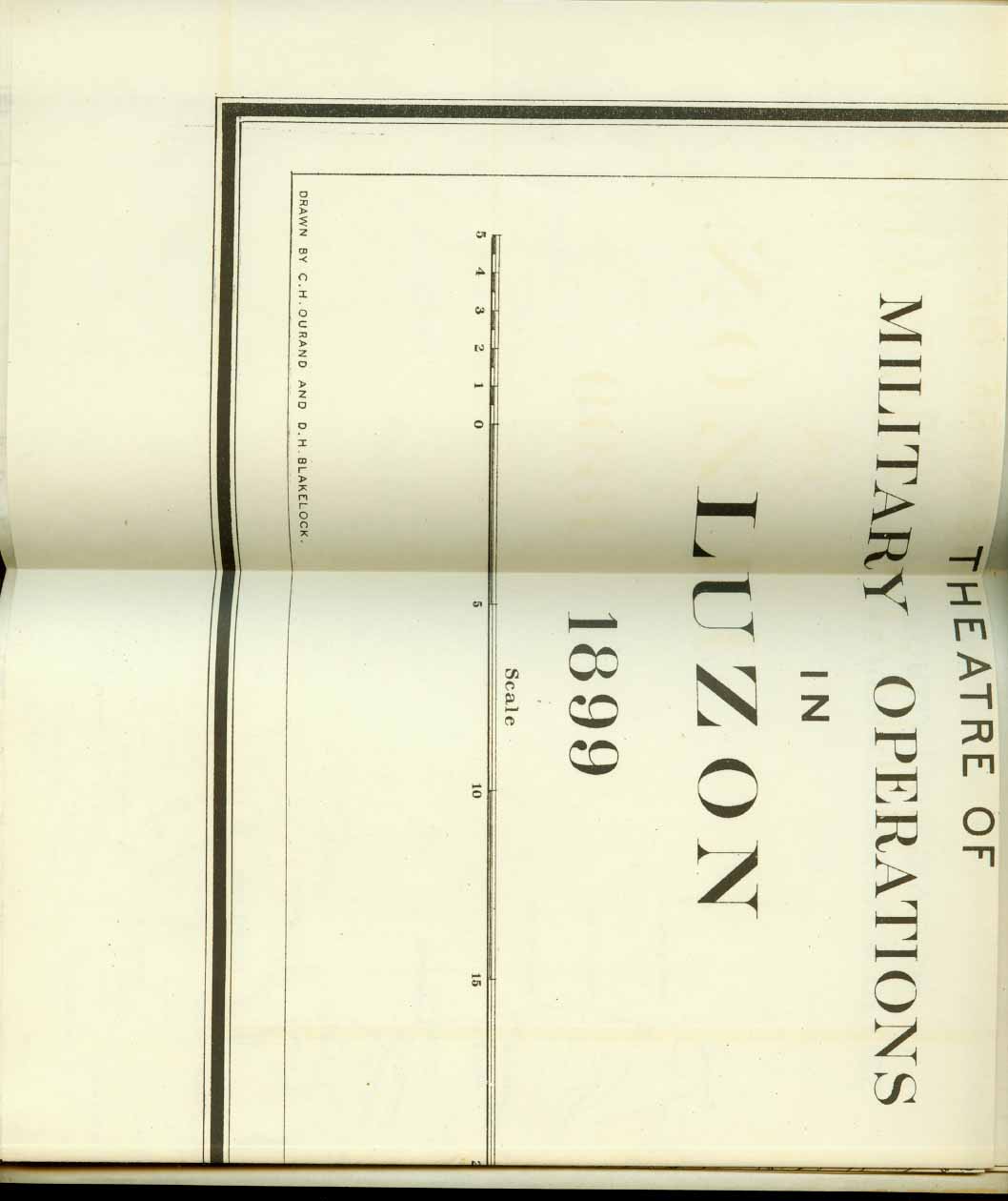
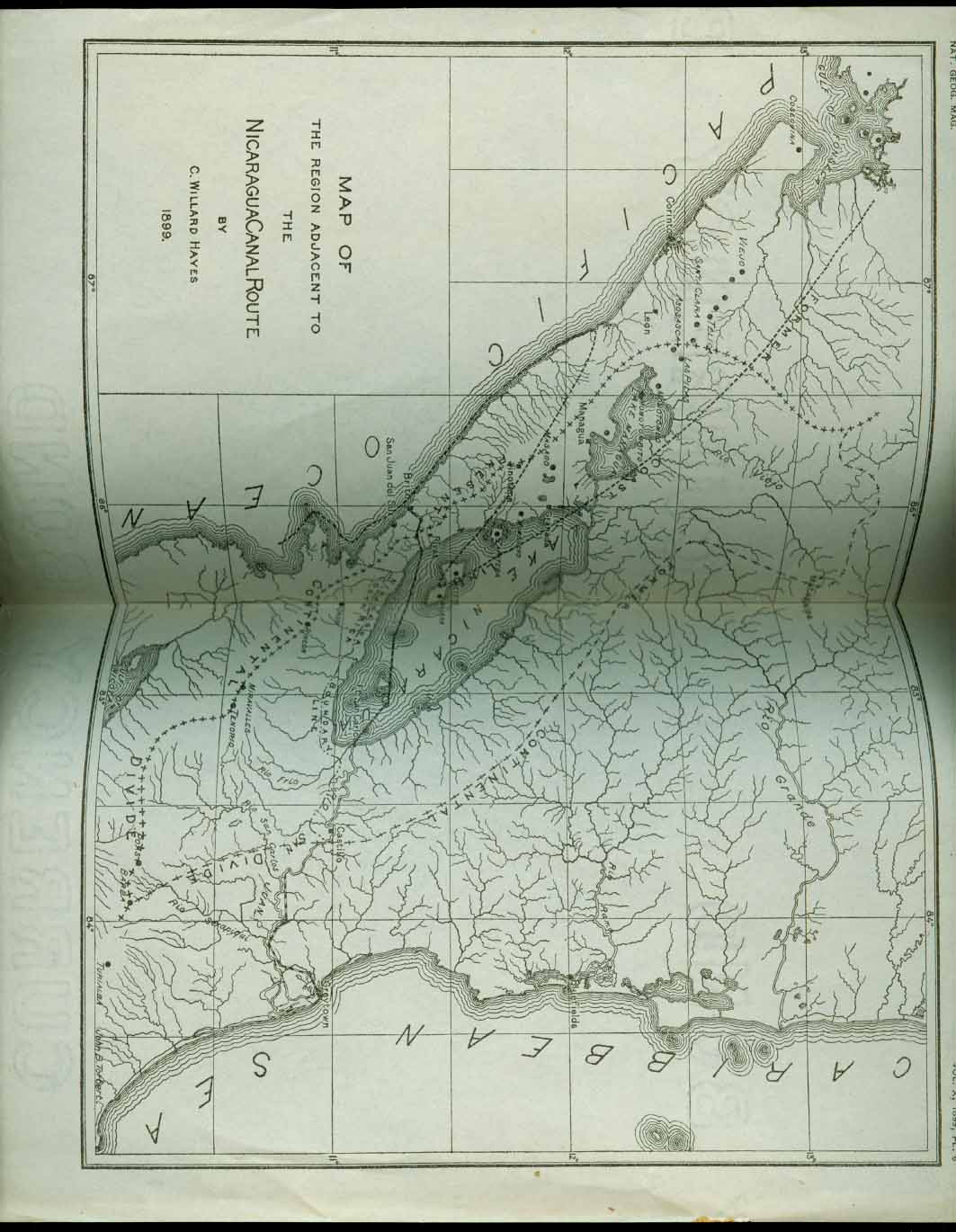
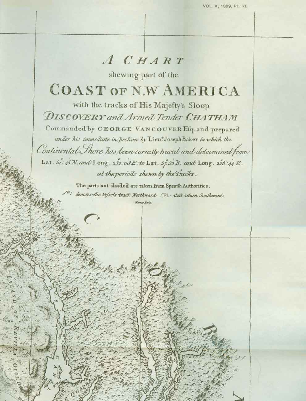
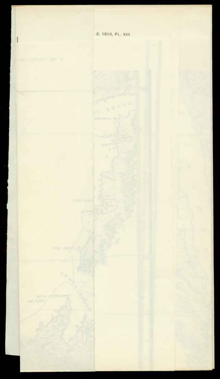
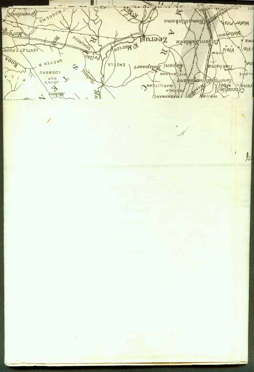
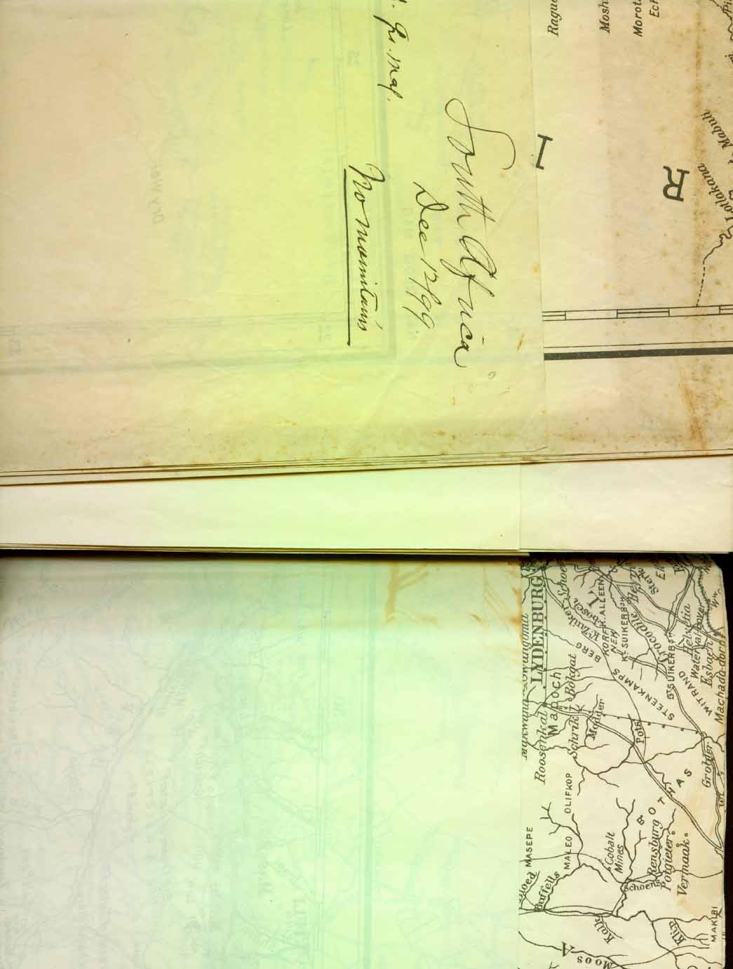
NGS MAPS LIST (Pictorials in RED) 1889 OCT. 1889 ASHEVILLE DISTRICT 1891 MAR. (28) 1891 SOUTH AMERICA 1892 FEB. (19) 1892 VOYAGES OF BERING MAR. (21) 1892 MUIR GLACIER MAR. (31) 1892 UNITED STATES 1893 APRIL (7) 1893 NUREMBERG CHRONICLE MAP, 1493 APRIL (7) 1893 JUAN de la COSA MAP, 1500 APRIL (7) 1893 RUYSCH MAP, 1508 1896 JAN. 1896 RUSSIA IN EUROPE FEB. 1896 ORINOCO RIVER THE MAR. 1896 SUBMARINE CABLES OF THE WORLD OCT. 1896 NANSEN EXPEDITION 1898 APRIL 1898 GOLD AND COAL FIELDS OF ALASKA MAY 1898 CUBA 1899 JUNE 1899 THEATER of MILITARY OPERATIONS in LUZON JULY 1899 REGION ADJACENT to the NICARAGUA CANAL ROUTE AUG. 1899 SOUTH POLAR REGIONS NOV. 1899 VANCOUVER’S CHART No. 1. NOV. 1899 VANCOUVER’S CHART No. 2. DEC. 1899 SEAT OF WAR IN AFRICA 1900
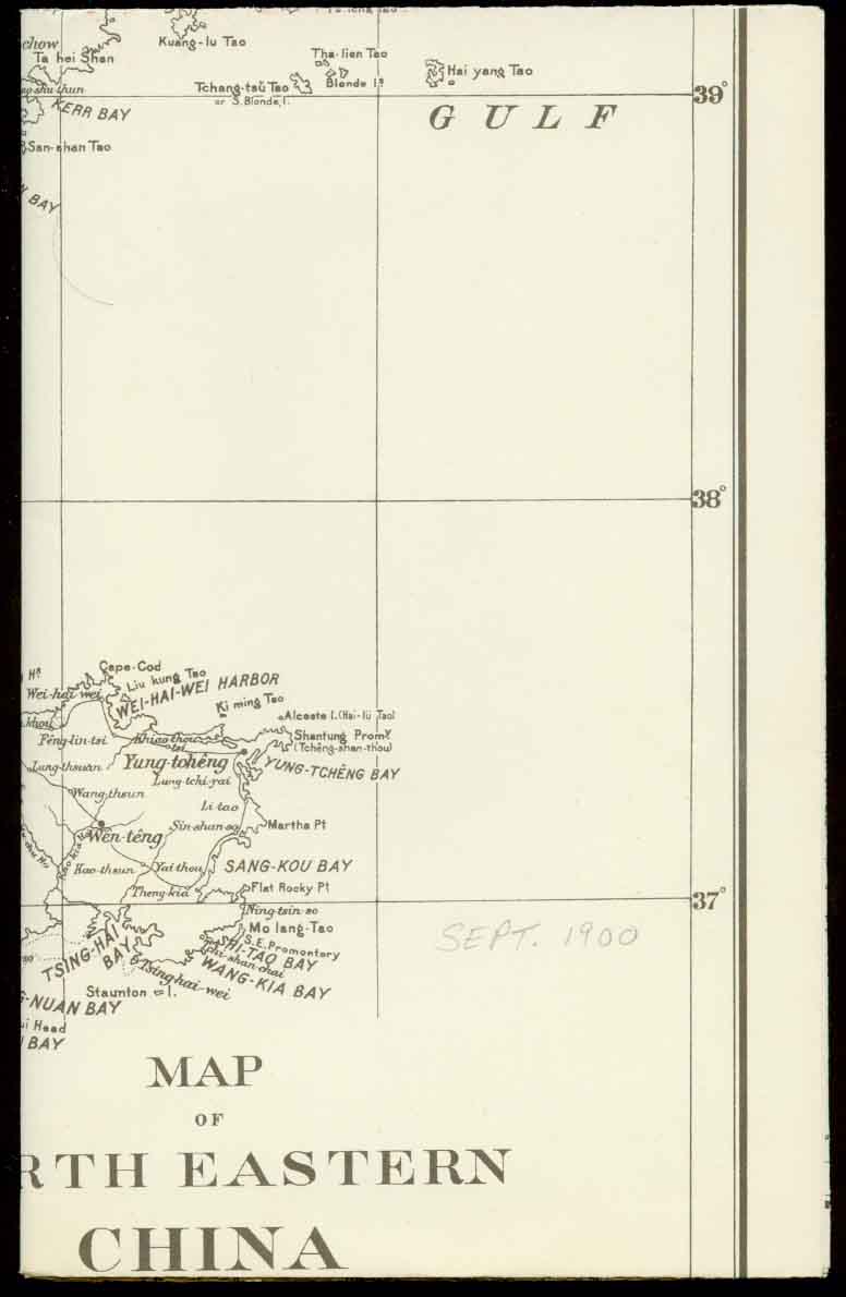
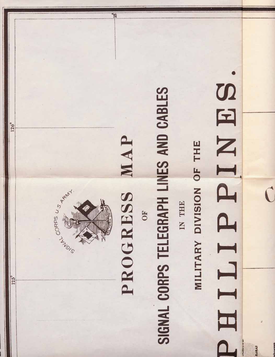
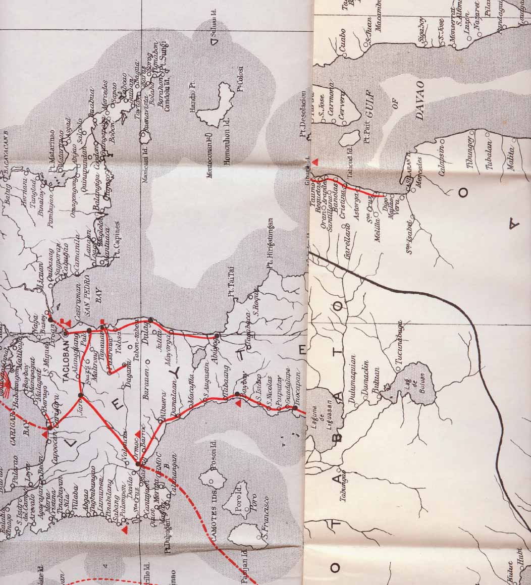
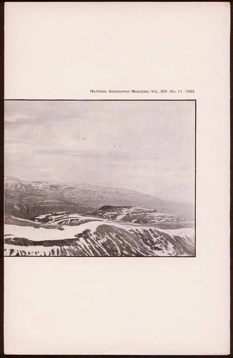
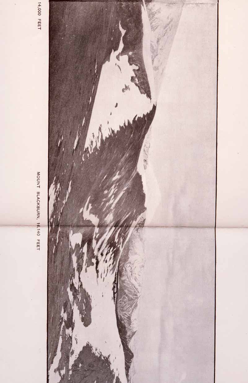
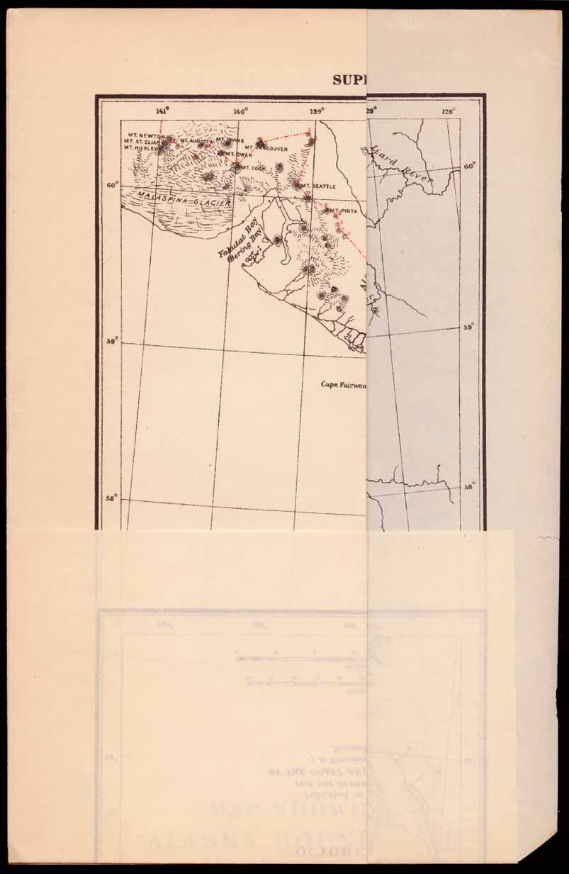
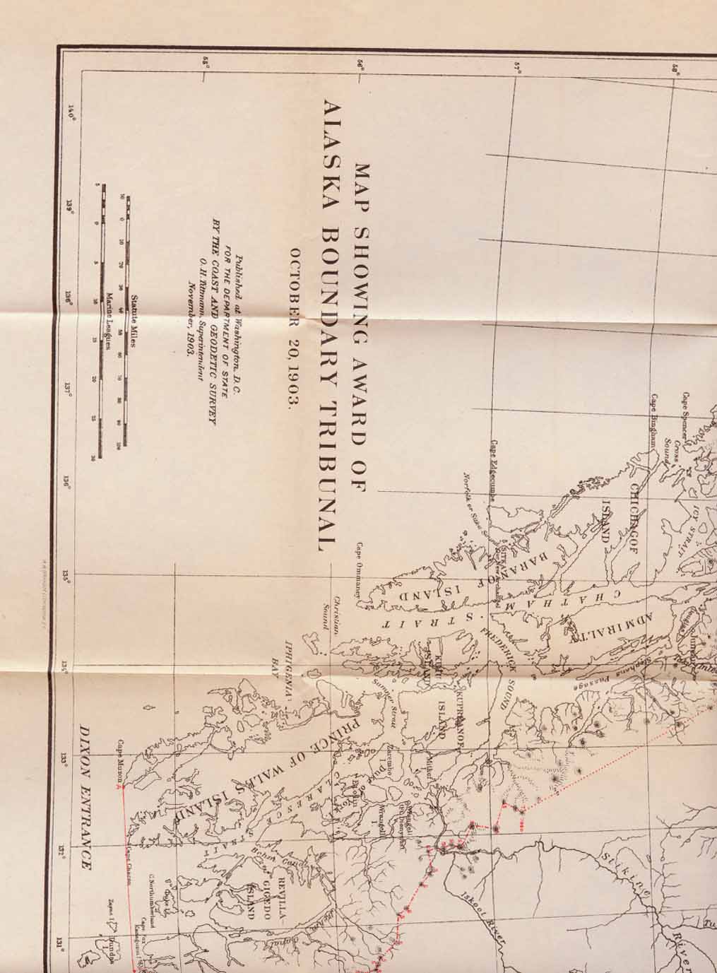
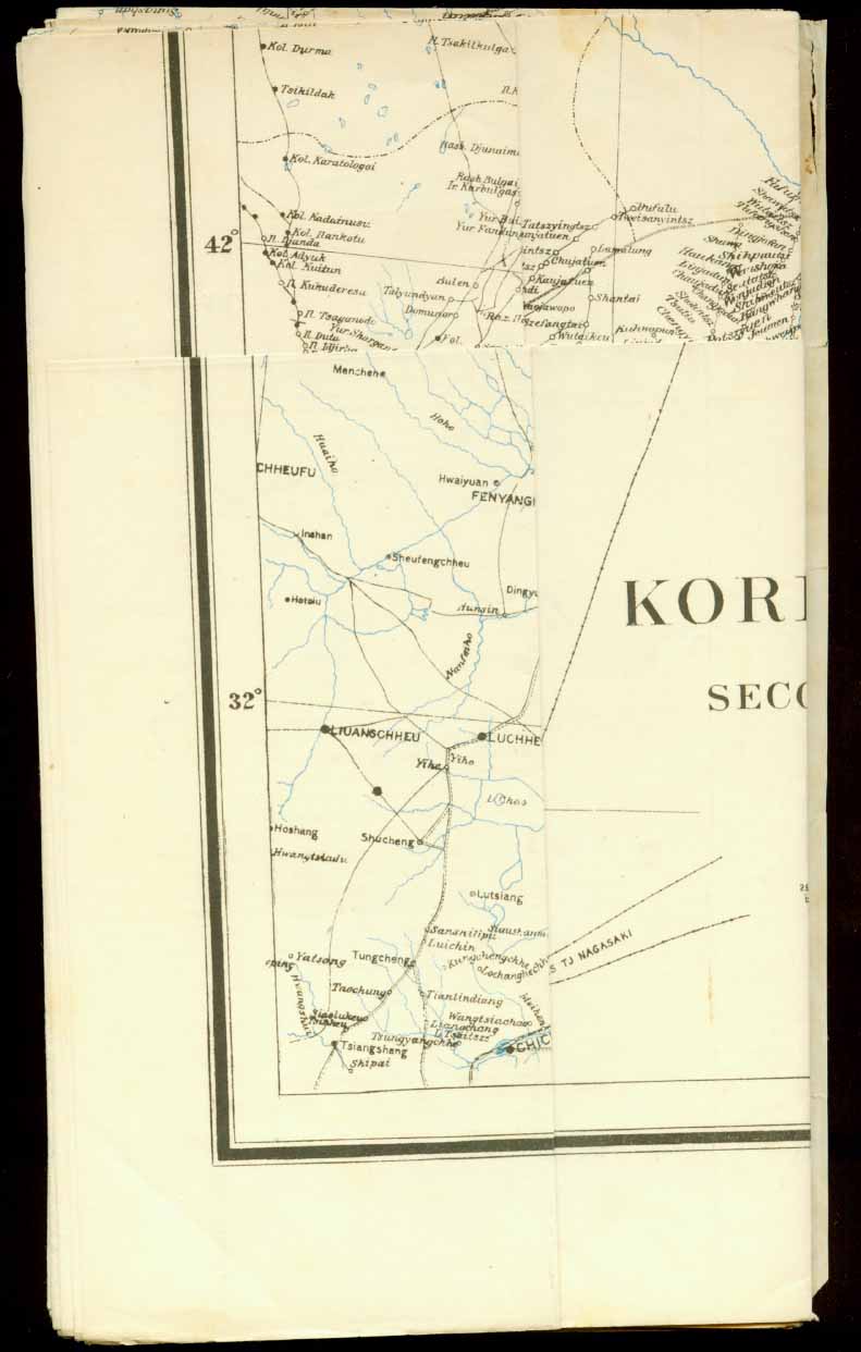
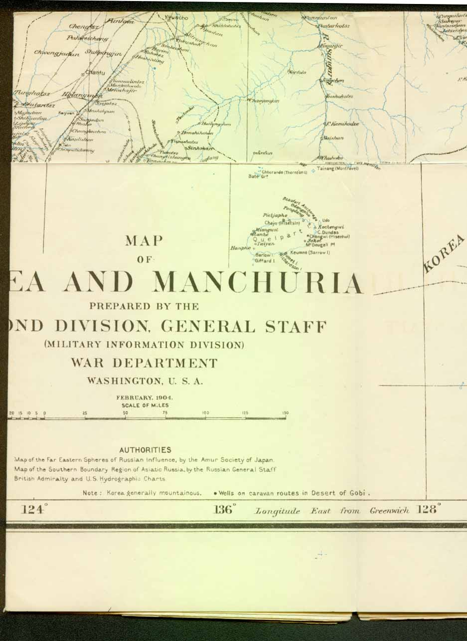
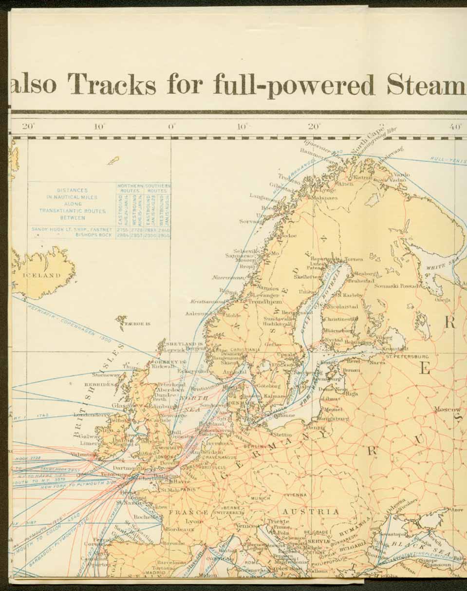
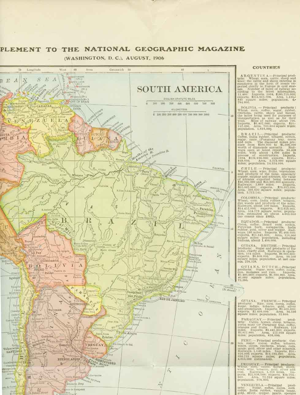
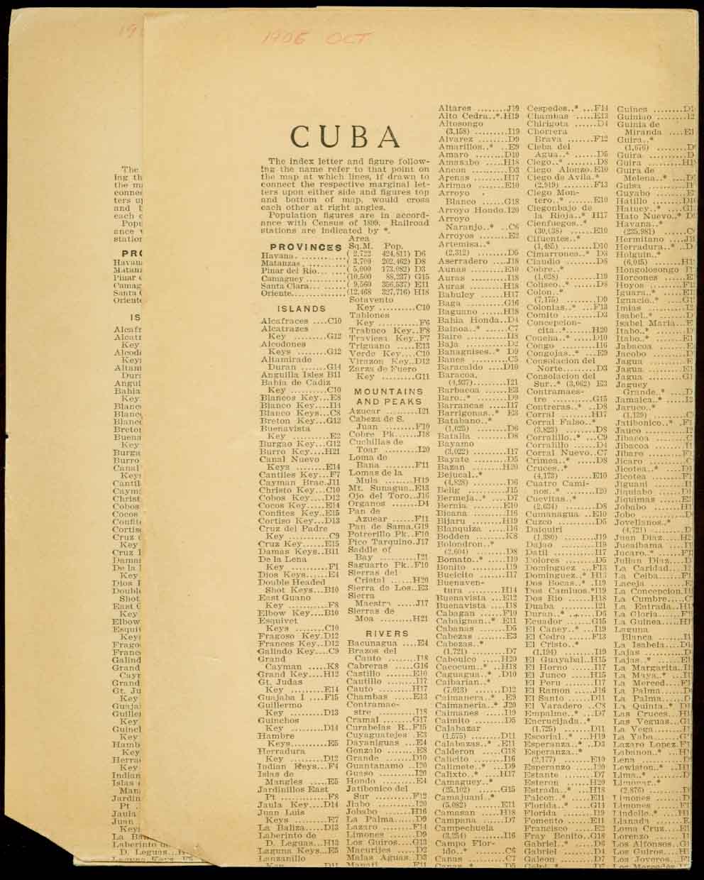
SEPT. 1900 NORTHEASTERN CHINA 1902 JAN. 1902 PHILIPPINES THE (TWO SIGNAL CORPS MAPS) 1903 FEB. 1903 PILOT CHART of the NORTH ATLANTIC NOV. 1903 PIC. WRANGELL MOUNTAINS, ALASKA1904 JAN. 1904 ALASKA BOUNDARY DECISION MAR. 1904 WAR MAP OF MANCHURIA AND KOREA MAY. 1904 ALASKA 1905 FEB. 1905 CHART OF THE WORLD ON MERCATOR’S PROJECTION JUNE 1905 SEAT OF WAR IN MANCHURIA AUG. 1905 PHILIPPINE ISLANDS OCT. 1905 LOCATION OF THE PANAMA CANAL 1906 JUNE 1906 COTIDAL LINES FOR THE WORLD AUG. 1906 SOUTH AMERICA OCT. 1906 CUBA
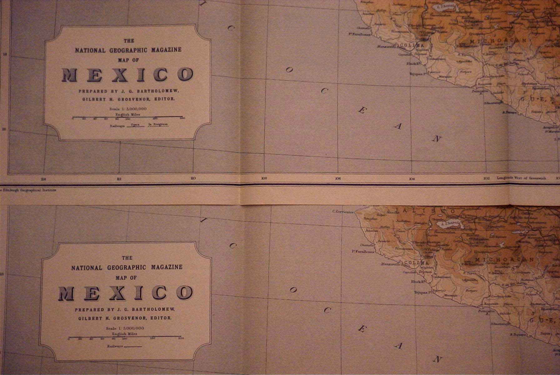
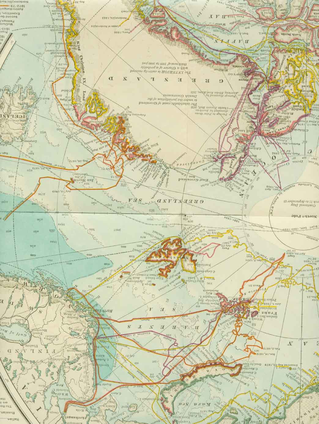
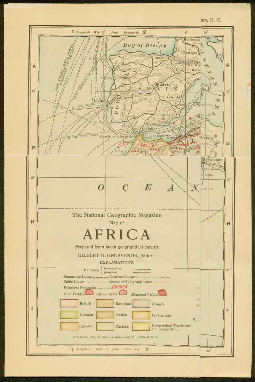
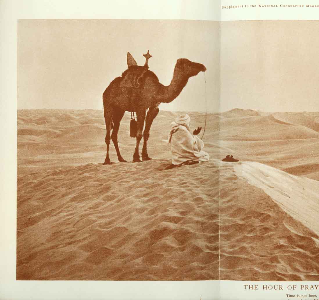
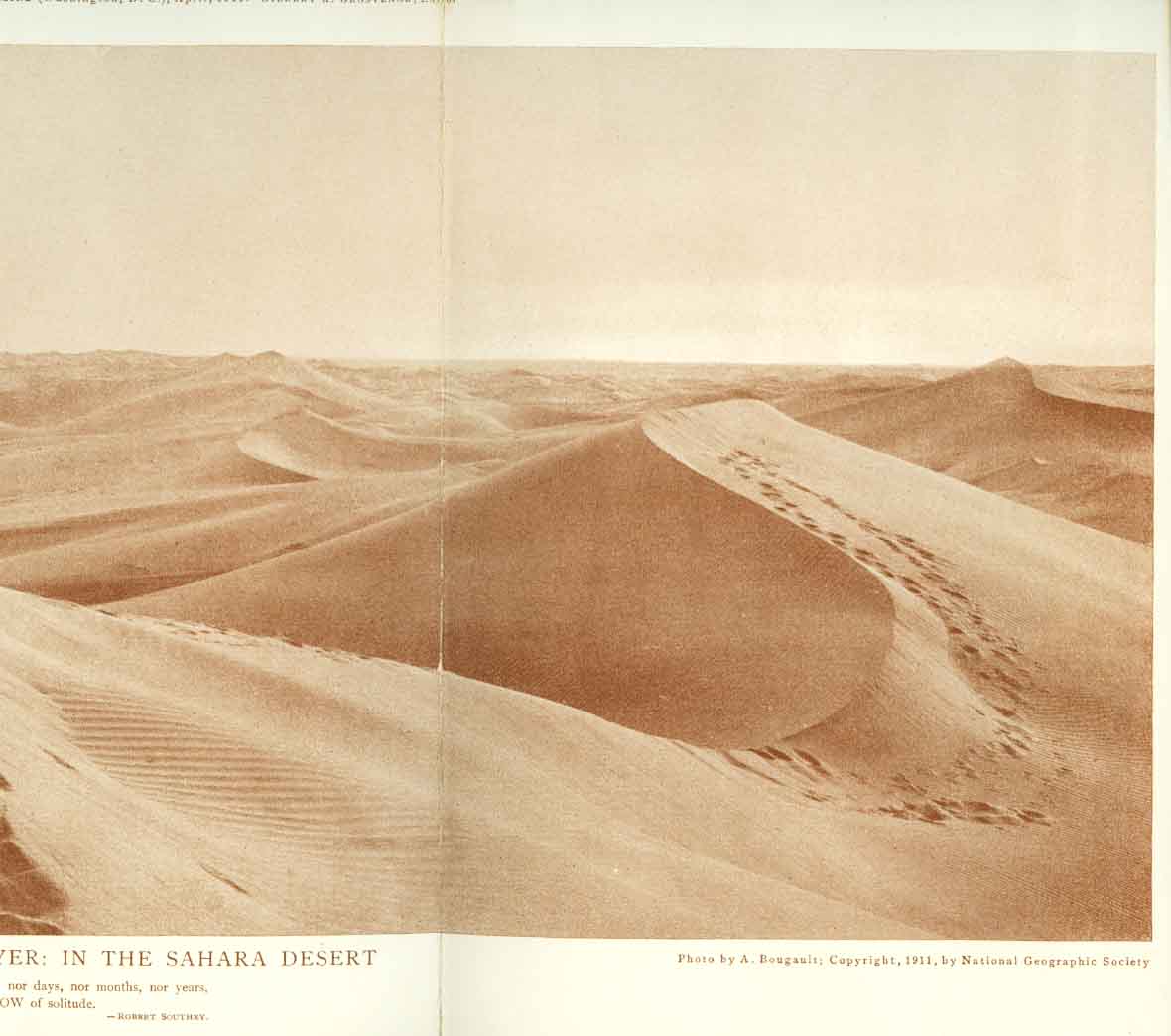
1907 JULY 1907 NORTH POLE REGIONS 1909 MAR. 1909 AFRICA 1911 APRIL 1911 PIC. THE HOUR OF PRAYER: IN THE SAHARA DESERTMAY 1911 MEXICO (like 1914 except only complete railroad lines shown)
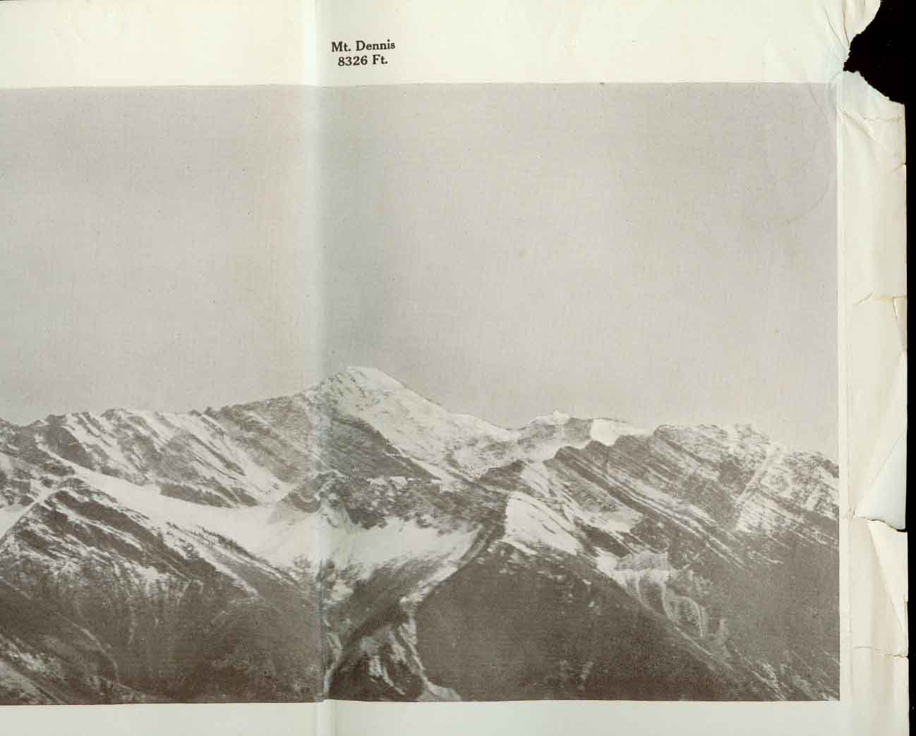
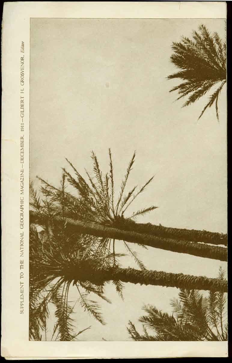
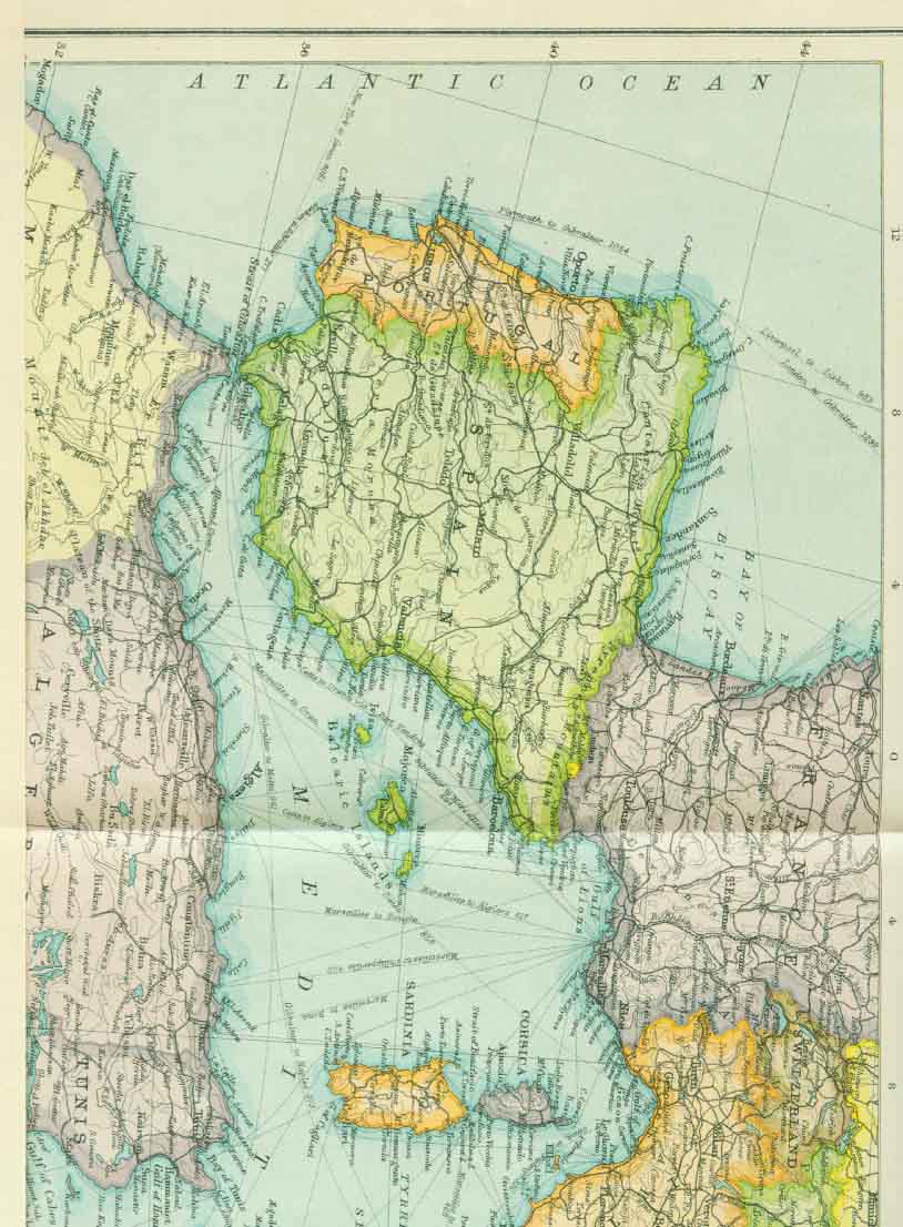
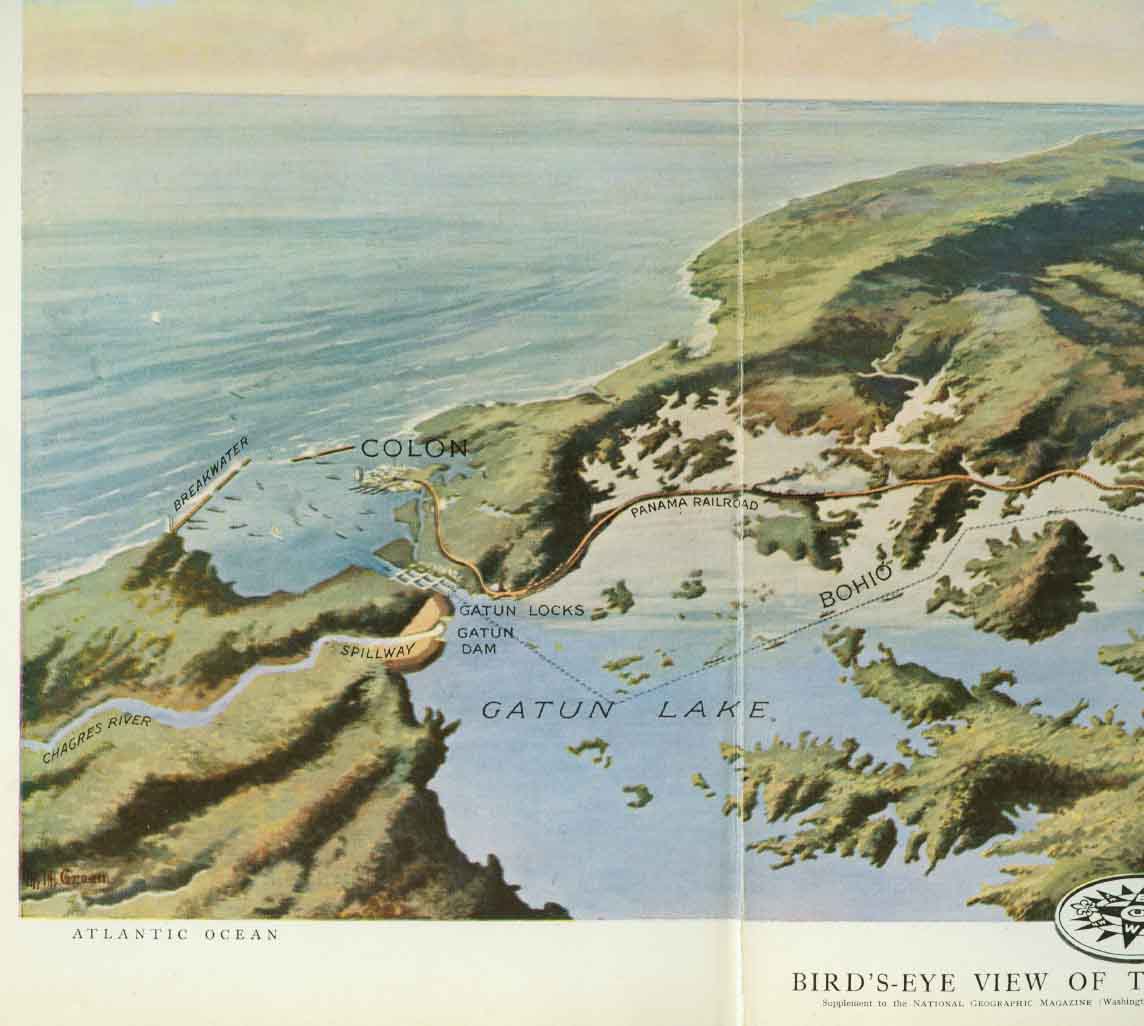
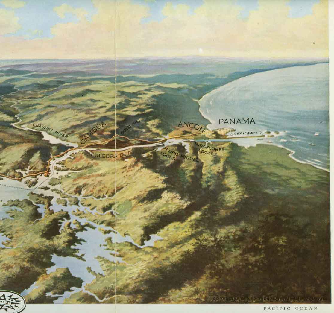
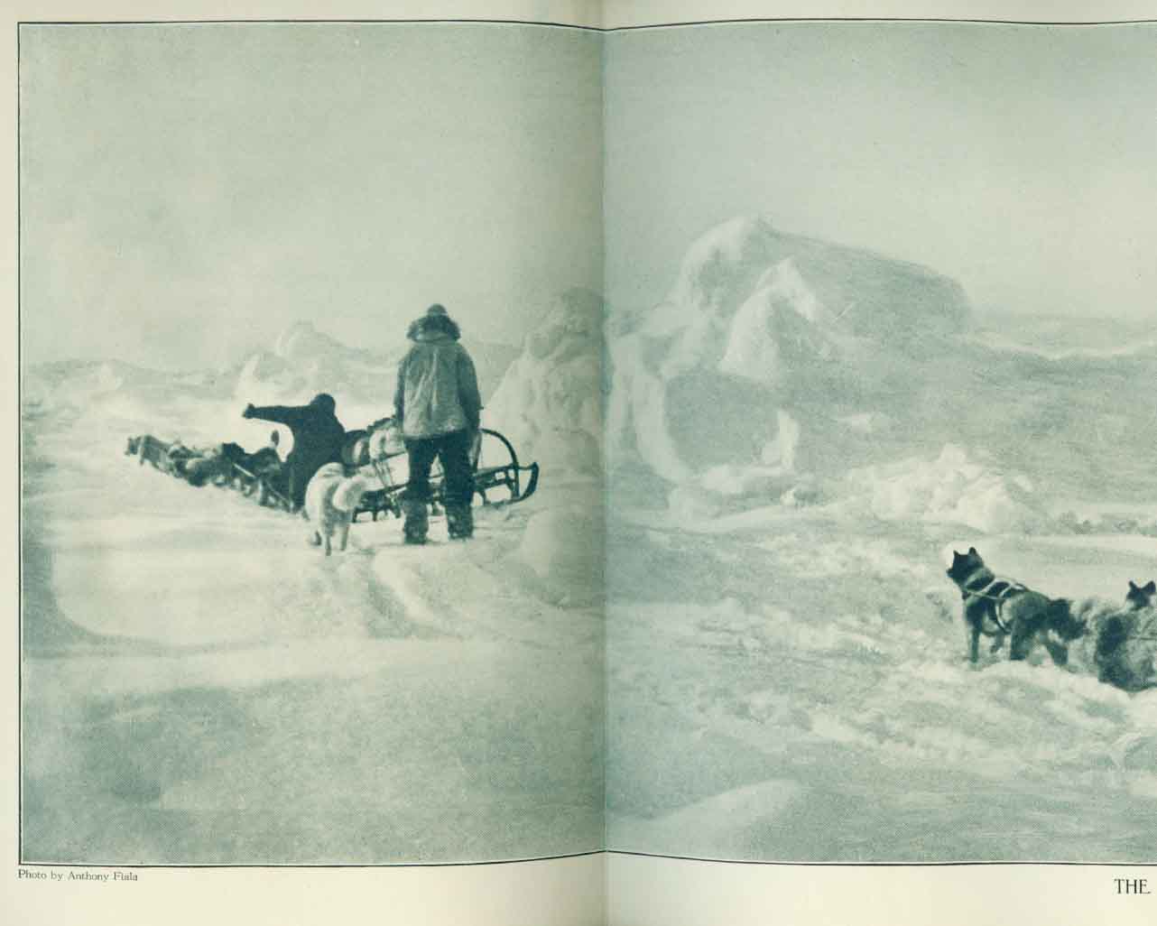
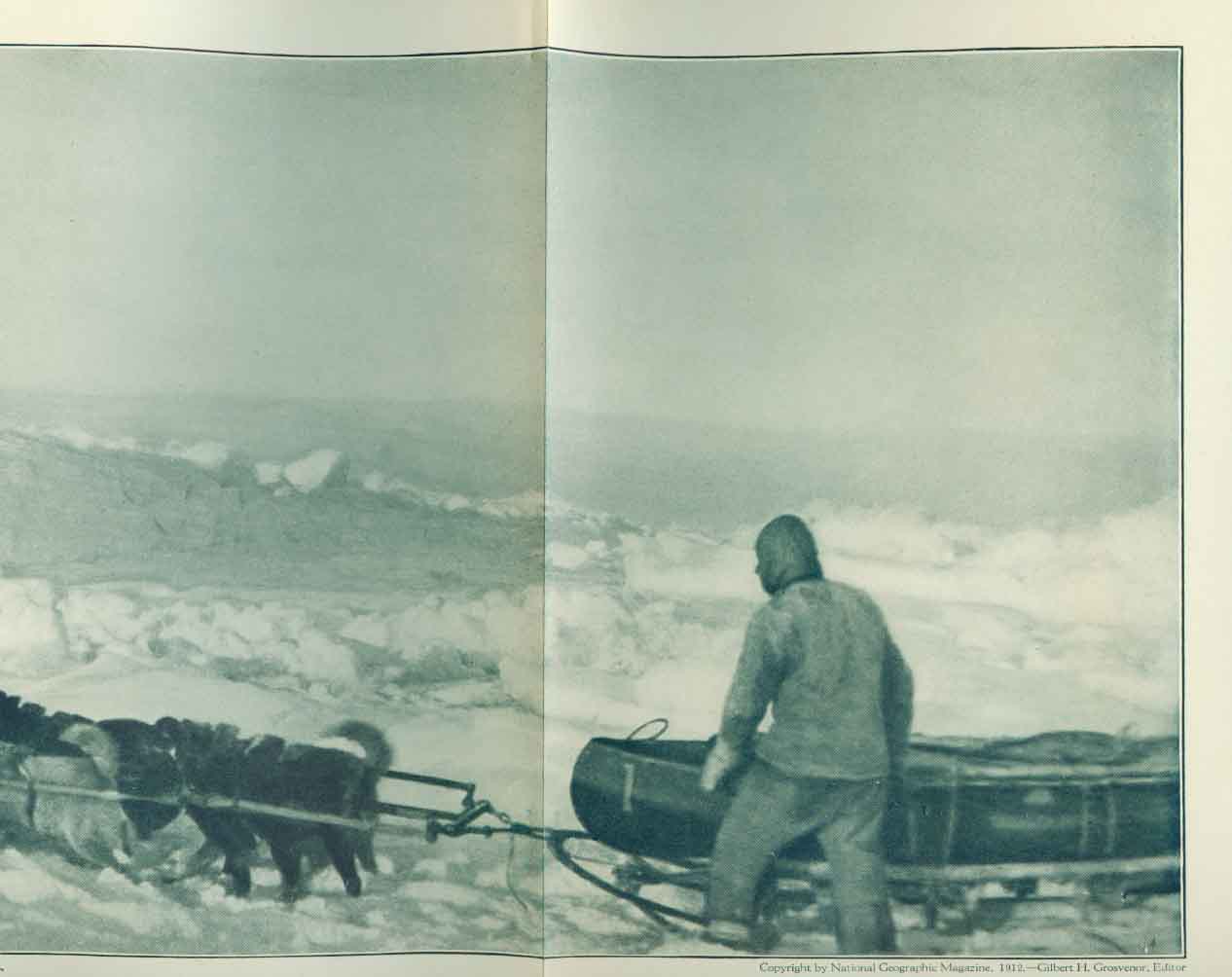
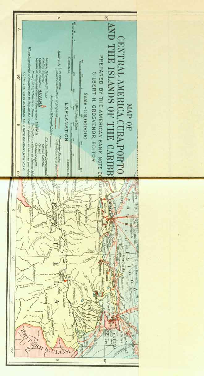
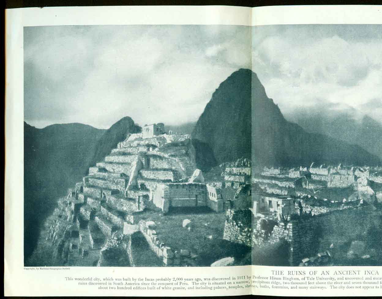
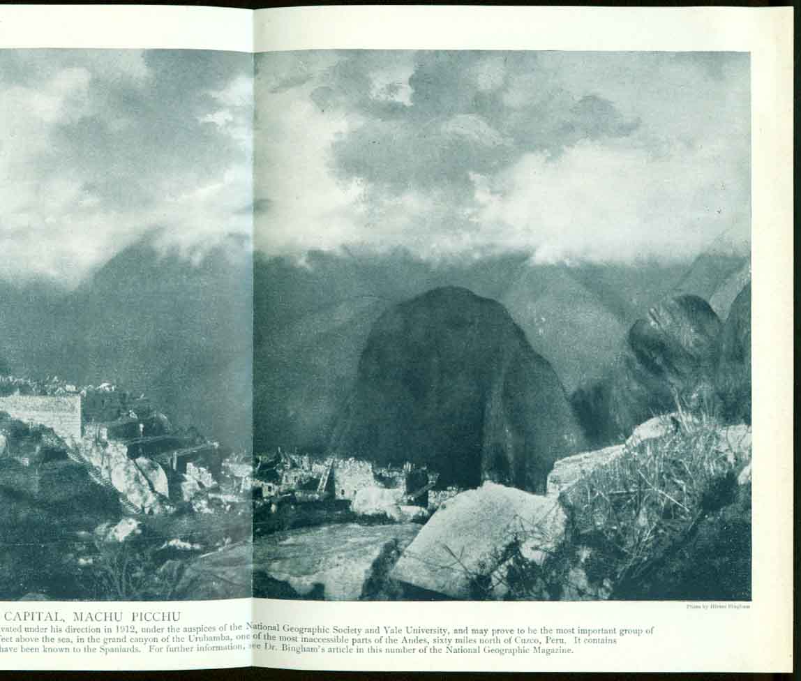
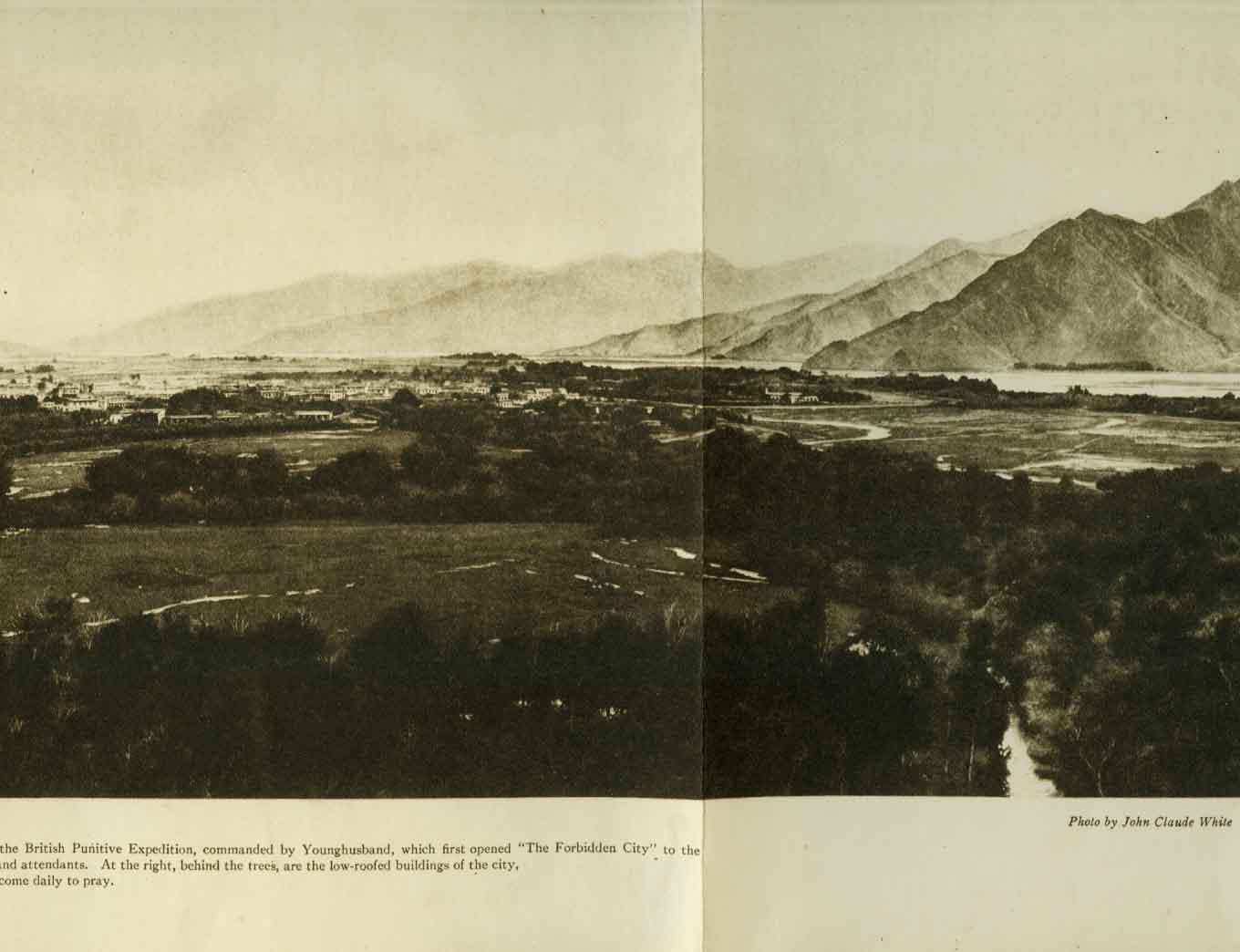
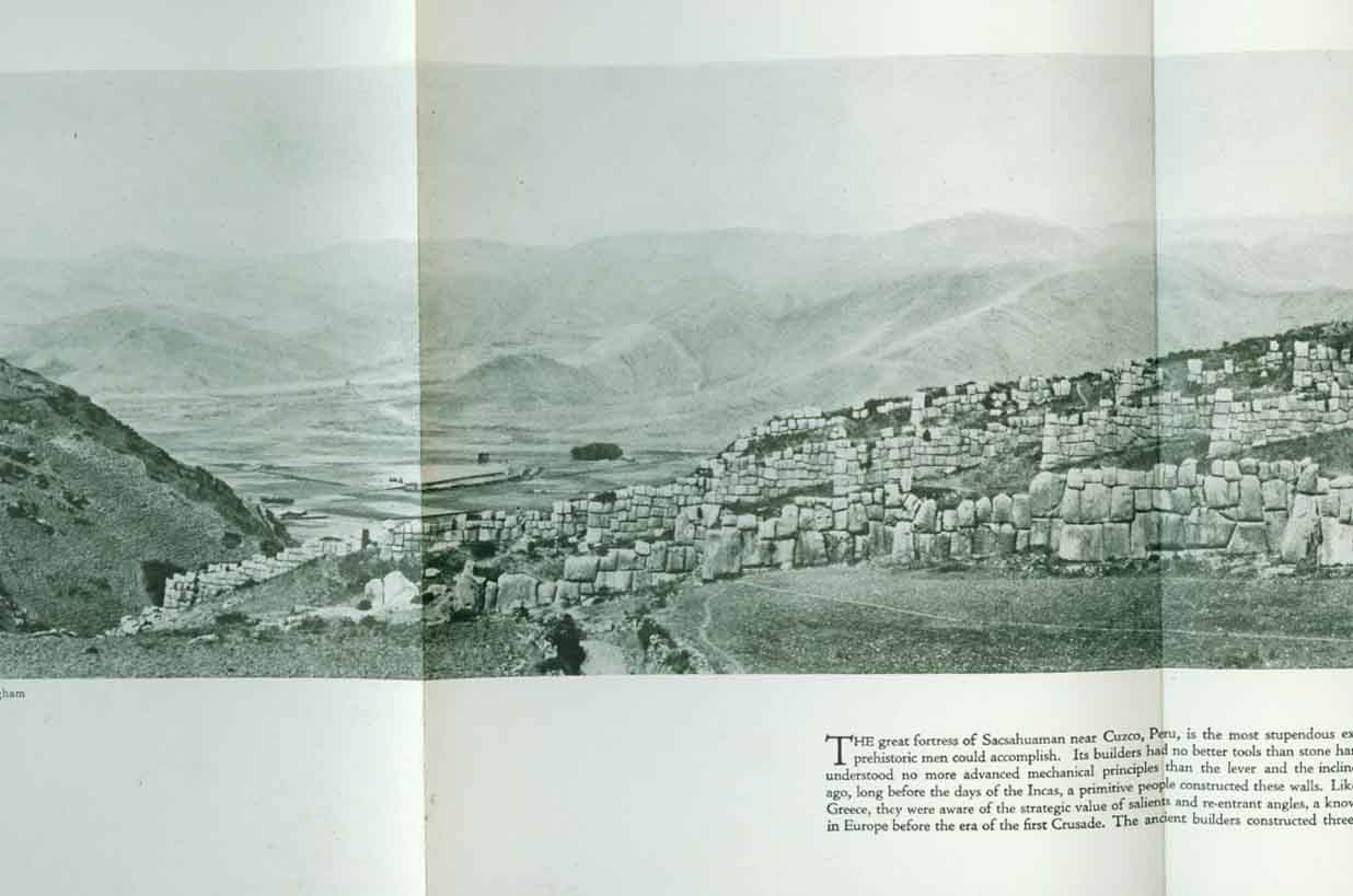
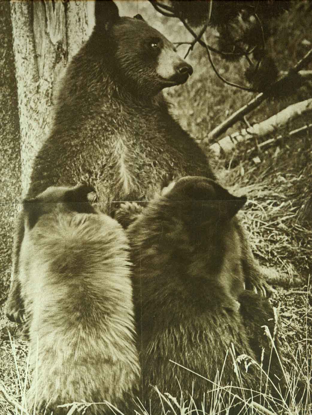
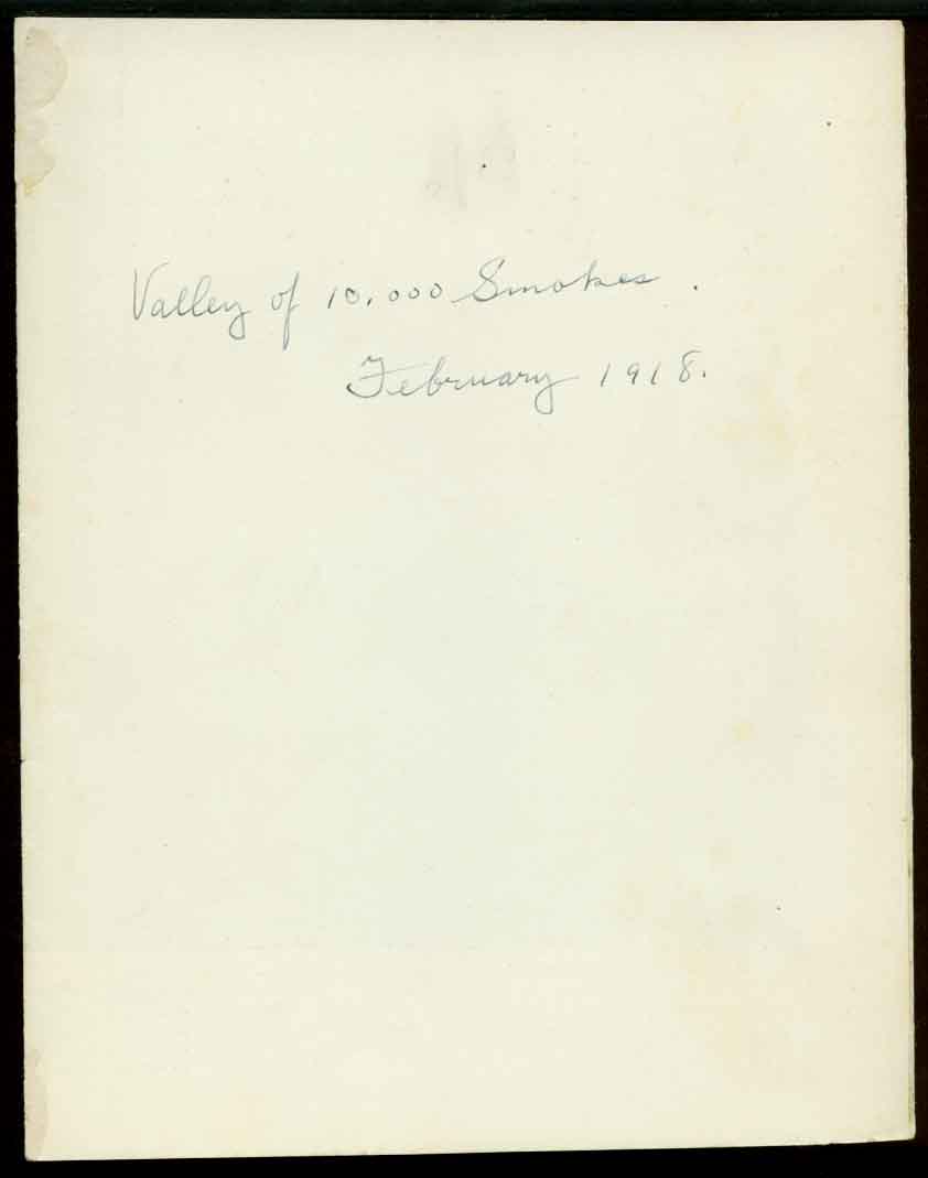
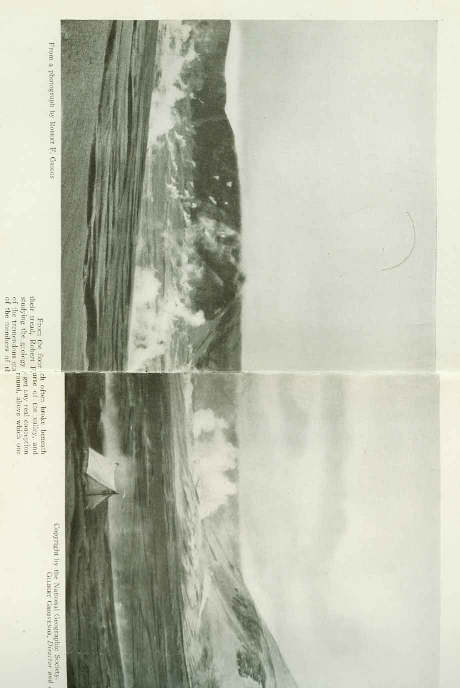
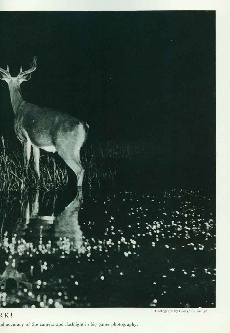
JUNE 1911 PIC. OUR MOUNTAIN PANORAMA (CANADIAN ROCKIES) DEC. 1911 PIC. THE PALMS1912 JAN. 1912 COUNTRIES BORDERING THE MEDITERRANEAN SEA FEB. 1912 PIC. BIRDS EYE VIEW OF THE PANAMA CANAL MAY 1912 PIC. MAJESTY OF THE MATTER HORNOCT. 1912 CHINA AND IT’S TERRITORIES DEC. 1912 PIC. LURE OF THE FROZEN DESSERT (POLAR REGIONS)1913 FEB. 1913 CENT. AMERICA, CUBA, PUERTO RICO AND THE IS. OF CARIBBEAN APRIL 1913 PIC. RUINS OF AN ANCIENT INCA CAPITAL, MACHU PICCHU MAY 1913 PIC. THE MONARCH OF THE CANADIAN ROCKIES - ROBSON PEAK JULY 1913 PIC. DOE AND TWIN FAWNS.1914 FEB. 1914 ALASKA MAY 1914 MEXICO (like 1911 except both comp/incomplete railroad lines shown) see may 1911 above) AUG. 1914 NEW BALKAN STATES & CENTRAL EUROPE 1915 MAR. 1915 PIC. MALL WASH. D.C. & ULTIMATE WASH.JULY 1915 EUROPE AND ADJACENT PORTIONS OF AFRICA AND ASIA 1916 MAR. 1916 PIC. LHASA-THE MECCA of the BUDDHIST FAITH APRIL 1916 PIC. OLDEST LIVING THING (GENERAL SHERMAN TREE) MAY 1916 PIC. FORTRESS of SACSAHUAMAN, PERU - GREATESTJULY 1916 MEXICO NOV. 1916 PIC. ALASKA BROWN BEAR1917 AUG. 1917 PIC. BABES IN THE WOODS1918 FEB. 1918 PIC. VALLEY OF TEN THOUSAND SMOKES, AWE-INSPIRINGMAY 1918 WESTERN THEATRE OF WAR DEC. 1918 RACES OF EUROPE - THE 1921 JAN. 1921 PIC. ARGOSY of GEOGRAPHY - theFEB. 1921 EUROPE as of PEACE CONFERENCE of PARIS MAY 1921 ASIA and ADJ. EUROPE with a PORTION of AFRICA AUG. 1921 PIC. HARK (DEER)OCT. 1921 SOUTH AMERICA DEC. 1921 MANDATORY AREAS in the PACIFIC 1922 FEB. 1922 COUNTRIES OF THE CARIBBEAN inclu. MEXICO, CENTRAL AMERICA, WEST INDIES, and the PANAMA CANAL OCT. 1922 AFRICA DEC. 1922 WORLD (political divisions after WWI) 1923 FEB. 1923 PIC. GREAT WALL of CHINA - TheAPRIL 1923 UNITED STATES SEPT 1923 PIC. PEASANT HOME in CORSICA1924 MAY 1924 NORTH AMERICA 1925 NOV. 1925 ARCTIC REGIONS - The 1926 MAY 1926 PIC. BOYHOOD of SIR WALTER RALEIGHSEPT. 1926 NORTH & SOUTH CAROLINA, GEORGIA & E. TENNESSEE 1927 FEB. MARYLAND, DELAWARE, and the DISTRICT of COLUMBIA NOV. 1927 PIC. VASCO De GAMA at the COURT of the ZAMORIN of CALICUT1928 MAR. 1928 PIC. DISCOVERER The (Wyeth) MAY 1928 PIC. COMMANDER BIRD at the NORTH POLE (Wyeth) JULY 1928 PIC. CARAVELS of COLUMBUS (Wyeth) SEPT. 1928 PIC. FATE DIRECTS the FALTERING FOOTSTEPS of COLUMBUS NOV. 1928 PIC. MAP of DISCOVERY (EASTERN HEMISPHERE) (Wyeth)1929 JAN. 1929 PIC. MAP of DISCOVERY (WESTERN HEMISPHERE) (Wyeth)DEC. 1929 EUROPE 1930 JAN, 1930 FLORIDA APRIL 1930 LOUISIANA 1931 MAY 1931 ILLINOIS 1932 JAN. 1932 TRAVELS of GEORGE WASHINGTON OCT. 1932 ANTARCTIC REGIONS DEC. 1932 WORLD 1933 MAY 1933 UNITED STATES NOV. 1933 PIC. PHOTO AERIAL MAP of NEW YORK CITYDEC. 1933 ASIA 1934 DEC. 1934 MEXICO, CENTRAL AMERICA, and the WEST INDIES 1935 JUNE 1935 AFRICA DEC. 1935 WORLD 1936 MAY 1936 PIC. CURVATURE of the EARTHJUNE 1936 CANADA DEC. 1936 PACIFIC OCEAN 1937 JUNE 1937 MODERN PILGRIM’S MAP of the BRITISH ISLES JULY 1937 WHITE MOUNTAINS of NEW HAMPSHIRE DEC. 1937 SOUTH AMERICA 1938 APRIL 1938 EUROPE and the MEDITERRANEAN (two versions published due to WWII changes) JULY 1938 HISTORIC and SCENIC REACHES of the NATION’S CAPITAL DEC. 1938 BIBLE LANDS and the CRADLE of WESTERN CIVILIZATION APRIL 1939 REACHES of NEW YORK CITY JULY 1939 ATLANTIC OCEAN OCT. 1939 CENTRAL EUROPE and the MEDITERRANEAN (two versions published due to WWII changes) (one is Aug. 28, 1939 - the other is Sept. 1, 1939). DEC. 1939 MEXICO, CENTRAL AMERICA and the WEST INDIES 1940 MAR. 1940 CLASSICAL LANDS of the MEDITERRANEAN MAY 1940 EUROPE and the NEAR EAST JUNE 1940 SOUTHWESTERN UNITED STATES DEC. 1940 UNITED STATES (of the 1940 CENSUS) 1941 MAR. 1941 INDIAN OCEAN including AUSTRALIA, NEW ZEALAND, and MALAYSIA JUNE 1941 NORTHWESTERN UNITED STATES and NEIGHBORING CANADA SEPT. 1941 ATLANTIC OCEAN DEC. 1941 WORLD 1942 FEB. 1942 THEATER of WAR in the PACIFIC OCEAN MAY 1942 NORTH AMERICA JULY 1942 THEATER of WAR in EUROPE, AFRICA, and WESTERN ASIA OCT. 1942 SOUTH AMERICA DEC. 1942 ASIA 1943 FEB. 1943 AFRICA APRIL 1943 NORTHERN and SOUTHERN HEMISPHERES JUNE 1943 EUROPE and the NEAR EAST SEPT 1943 PACIFIC OCEAN and the BAY of BENGAL DEC. 1943 WORLD 1944 APRIL 1944 JAPAN and ADJACENT REGIONS of ASIA and the PACIFIC JULY 1944 GERMANY and it’s APPROACHES OCT. 1944 SOUTHEAST ASIA and PACIFIC ISLANDS from the INDIES and the PHILIPPINES to the SOLOMONS DEC. 1944 UNION of SOVIET SOCIALIST REPUBLICS (RUSSIA) 1945 MAR. 1945 The PHILIPPINES JUNE 1945 CHINA SEPT. 1945 NORTHEASTERN UNITED STATES DEC. 1945 JAPAN and KOREA 1946 FEB. 1946 NORTHERN HEMISPHERE APRIL 1946 INDIA and BURMA JULY 1946 UNITED STATES of AMERICA DEC. 1946 BIBLE LANDS and the CRADLE OF WESTERN CIVILIZATION 1947 FEB. 1947 SOUTHEASTERN UNITED STATES JUNE 1947 CANADA, ALASKA, and GREENLAND OCT. 1947 COUNTRIES of the CARIBBEAN DEC. 1947 SOUTH CENTRAL UNITED STATES 1948 MAR. 1948 AUSTRALIA JUNE 1948 NORTH CENTRAL UNITED STATES SEPT. 1948 WASHINGTON (D.C.) DEC. 1948 SOUTHWESTERN UNITED STATES 1949 APRIL 1949 BRITISH ISLES JUNE 1949 EUROPE and the NEAR EAST (POST WWII EUROPE) OCT. 1949 TOP of the WORLD DEC. 1949 CLASSICAL LANDS of the MEDITERRANEAN 1950 MAR. 1950 AFRICA JUNE 1950 NORTHWESTERN UNITED STATES and NEIGHBORING CANADIAN PROVINCES OCT. 1950 SOUTH AMERICA DEC. 1950 WESTERN EUROPE 1951 MAR. 1951 ASIA and ADJACENT AREAS JUNE 1951 UNITED STATES SEPT. 1951 CENTRAL EUROPE DEC. 1951 The WORLD 1952 JAN. 1952 PIC. The ADORATION of the MAGIMAR. 1952 NORTH AMERICA JUNE 1952 SOUTHWEST ASIA SEPT. 1952 FAR EAST DEC. 1952 PACIFIC OCEAN 1953 MAR. 1953 MEXICO and CENTRAL AMERICA JUNE 1953 UNITED STATES, HISTORICAL MAP OCT. 1953 CHINA COAST and KOREA DEC. 1953 GREAT LAKES REGION 1954 MAR. 1954 WEST INDIES JUNE 1954 CALIFORNIA AUG. 1954 NORTHERN EUROPE DEC. 1954 NORTHERN AFRICA 1955 MAR. 1955 EASTERN SOUTH AMERICA JUNE 1955 NEW ENGLAND SEPT. 1955 SOUTHEAST ASIA DEC. 1955 ATLANTIC OCEAN 1956 APRIL 1956 ROUND ABOUT The NATION'S CAPITAL- WASH. (D.C.) AREA JUNE 1956 ALASKA SEPT. 1956 UNITED STATES DEC. 1956 BIBLE LANDS 1957 MAR. 1957 The WORLD JUNE 1957 EUROPE SEPT. 1957 ANTARCTICA NOV. 1957 PIC. MAYFLOWER IIDEC. 1957 DMS MAP of the HEAVENS-SKY CHARTS (first DMS?) 1958 -----The START of ATLAS MAPS
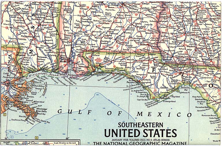
MAR. 1958 SOUTHERN SOUTH AMERICA A#28 MAY 1958 DMS NATIONAL PARKS-PARK MAP ENLARGEMENTS A#13 MAY 1958 FOLD OUT GENERAL SHERMAN TREE (also as PIC. from N.G.) JULY 1958 BRITISH ISLES SEPT. 1958 POLAND and CZECHOSLOVAKIA A#38 NOV. 1958 NORTH CENTRAL UNITED STATES A#9 DEC. 1958 GREECE and the AEGEAN A#40 1959 JAN. 1959 EASTERN MEDITERRANEAN A#47 APRIL 1959 NORTHEASTERN UNITED STATES A#6 JUNE 1959 GERMANY A#35 JULY 1959 ALASKA A#18 SEPT. 1959 WESTERN SOVIET UNION A#45 NOV. 1959 SOUTHWESTERN UNITED STATES A#12 DEC. 1959 ASIA and ADJACENT AREAS A#44 1960 FEB. 1960 SOUTH AMERICA A#25 APRIL 1960 NORTHWESTERN UNITED STATES A#11 (map listings in red on spine start here) JUNE 1960 FRANCE, BELGIUM and the NETHERLANDS A#32 JULY 1960 HAWAII A#15 (see also 7/64) SEPT. 1960 AFRICA A#54 NOV. 1960 The WORLD A#2 DEC. 1960 JAPAN and KOREA A#51 1961 FEB. 1961 SOUTH CENTRAL UNITED STATES A#10 APRIL 1961 BATTLEFIELDS of the CIVIL WAR A#14 MAY 1961 SOUTHEAST ASIA A#49 JULY 1961 UNITED STATES A#5 OCT. 1961 MEXICO and CENTRAL AMERICA A#22 NOV. 1961 ITALY A#37 DEC. 1961 CANADA A#19 1962 FEB. 1962 The BALKANS A#39 APRIL 1962 DMS The PACIFIC OCEAN-ISLAND GROUPS A#61 JUNE 1962 EUROPE A#30 AUG. 1962 WASHINGTON TO BOSTON - "MEGALOPOLIS MAP" A#7 SEPT. 1962 EASTERN SOUTH AMERICA A#27 NOV. 1962 SOUTHERN AFRICA A#57 DEC. 1962 WEST INDIES A#23 1963 FEB. 1963 ANTARCTICA A#65 APRIL 1963 SCANDINAVIA A#34 MAY 1963 SOUTHWEST ASIA A#48 JULY 1963 CENTRAL CANADA A#24 SEPT. 1963 AUSTRALIA A#59 OCT. 1963 AFRICA, COUNTRIES of the NILE A#56 DEC. 1963 HOLY LAND TODAY A#52 1964 FEB. 1964 NORTHWESTERN SOUTH AMERICA A#26 APRIL 1964 NORTH AMERICA A#17 MAY 1964 SMS SHAKESPEARE’S BRITAIN (NOT AN ATLAS MAP) (first cover to designate SMS) JULY 1964 DMS GREATER NEW YORK, TOURIST MANHATTAN A#15 (see 760) NOV. 1964 CHINA A#50 DEC. 1964 DMS SUBURBAN and TOURIST WASHINGTON (see also 9/66) 1965 JAN. 1965 SMS VIET NAM-PLACE NAMES/military oriented (not an atlas map) FEB. 1965 The WORLD (not an atlas map) MAR. 1965 SPAIN and PORTUGAL A#33 MAY 1965 SMS The NILE VALLEY-YOUR INTRO. to ANCIENT EGYPT A#58 AUG. 1965 REC CHURCHILL FUNERAL and his Speech Excerpts SEPT. 1965 DMS SWITZERLAND, AUSTRIA, and NORTHERN ITALY-ALPS A#36 NOV. 1965 TOP of the WORLD A#3 1966 MAY 1966 DMS CALIFORNIA A#’s 68 & 69 (NORTH and SOUTH) JULY 1966 SMS VACATIONLANDS-INDEX of VACATION SPOTS (not an atlas map) AUG. 1966 NORTHWESTERN AFRICA A#55 SEPT. 1966 WESTERN CANADA A#21 1967 FEB. 1967 VIET NAM, CAMBODIA, LAOS, and THAILAND (not an atlas map) MAR. 1967 EASTERN SOVIET UNION A#46 MAY 1967 EASTERN CANADA A#20 OCT. 1967 INDIAN OCEAN FLOOR A#63 DEC. 1967 LANDS of the BIBLE TODAY (not an atlas map) 1968 FEB. 1968 The UNITED STATES (not an atlas map) JUNE 1968 DMS ATLANTIC OCEAN, ATLANTIC OCEAN FLOOR A#62 (END of Atlas Maps) OCT. 1968 SMS ARCHAEOLOGICAL MAP of MIDDLE AMERICA-VALLEY of MEXICO DEC. 1968 SOUTHEAST ASIA 1969 FEB. 1969 SMS The EARTH’s MOON-SPECIAL SHOWING OF SPACECRAFT LANDINGS JUNE 1969 EUROPE OCT. 1969 DMS PACIFIC OCEAN - PACIFIC OCEAN FLOOR DEC. 1969 REC SOUNDS OF THE SPACE AGE 1970 JAN. 1970 WEST INDIES and CENTRAL AMERICA JUNE 1970 A TRAVELERS MAP of ITALY AUG. 1970 DMS The HEAVENS-STAR CHARTS DEC. 1970 DMS The WORLD-POLLUTION PAINTING 1971 MAR. 1971 DMS PEOPLE OF MAINLAND SOUTHEAST ASIA JUNE 1971 SUP TRAVELERS MAP OF FRANCE OCT, 1971 DMS ARCTIC OCEAN FLOOR DEC, 1971 DMS MANY FACES OF AFRICA 1972 MAR. 1972 DMS CANADA JULY 1972 DMS MIDDLE EAST OCT. 1972 DMS SOUTH AMERICA DEC. 1972 DS PRE COLUMBUS & INDIANS OF N. AMERICA 1973 FEB. 1973 DS PLANET MARS - MAP & PAINTING
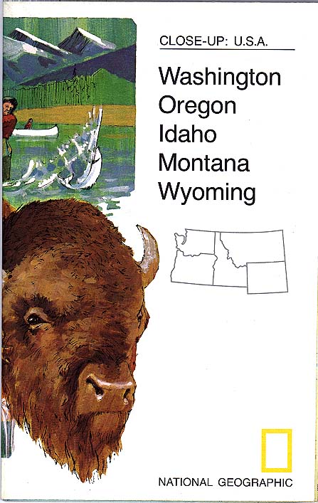
MAY. 1973 DMS MEXICO & CENTRAL AMERICA AUG. 1973 SUP CLOSE UP #2 - WISCONSIN-MICHIGAN-LAKES SEP. 1973 DMS APOLLO ASTRONAUTS & EARTH FROM SPACE NOV. 1973 SUP CLOSE UP #3 - PUERTO RICO & VIRGIN IS. & FLORIDA 1974 MAR. 1974 SUP CLOSE UP #4 - NORTH CENTRAL STATES APR. 1974 SUP TRAVELER'S MAP OF THE BRITISH ISLES JUN. 1974 SUP CLOSE UP #*5 - CALIFORNIA & NEVADA OCT. 1974 SUP CLOSE UP #6 - ARK. OKLA.. LA. & TX. DEC. 1974 DS PACIFIC ISLANDS & DISCOVERERS 1975 MAR. 1975 SUP CLOSE UP #7 - MAINE & CANADA JUNE 1975 SUP CLOSE UP #8 - ALASKA JULY 1975 SUP CLOSE UP #9 - WESTERN NEW ENGLAND OCT. 1975 SUP CLOSE #10- SOUTHEAST STATES NOV. 1975 DMS WORLD - The POLITICAL & PHYSICAL 1976 FEB. 1976 DMS PEOPLES OF U.S.S.R. APR. 1976 SUP CLOSE UP #11 - HAWAII JULY 1976 DS USA MAP & PORTRAIT LOWER "48" OCT. 1976 SUP CLOSE UP #12 - MID ATLANTIC STATES DEC. 1976 DS WHALES 1977 FEB. 1977 SUP CLOSE UP #13 - ILL. IND. OHIO & KENTUCKY MAY 1977 DS CELTIC EUROPE JULY 1977 DS AMERICAN WILD & SCENIC RIVERS OCT. 1977 SUP CLOSE UP #14 - SOUTHWEST STATES DEC. 1977 DS COLONIZATION OF THE NEW WORLD 1978 JAN. 1978 SUP CLOSE UP #15 - NORTHEASTERN STATES APR. 1978 SUP CLOSE UP #16 - B.C. ALBERTA, & THE YUKON JULY 1978 DS GRAND CANYON SEP. 1978 DMS MIDEAST & EARLY CIVILIZATION DEC. 1978 SUP CLOSE UP #17 - ONTARIO 1979 JAN. 1979 REC WHALE SOUNDS FEB. 1979 DS AUSTRALIAN FOSSILS MAR. 1979 TOS WILDLIFE REFUGES (NOT OUT OF MAG) MAY 1979 SUP CLOSE UP #18 - CANADA & NORTHWEST TERRITORIES AUG. 1979 DS AMERICAS & BIRD MIGRATIONS OCT. 1979 DMS BRITISH IS. & MEDIEVAL ENGLAND 1980 FEB. 1980 DMS AFRICA & IT'S POLITICAL DEVELOPMENT MAY 1980 SUP CLOSEUP #19 - QUEBEC & NEWFOUNDLAND JULY 1980 DMS CHINA & IT'S PEOPLE SEP. 1980 SMS MIDDLE EAST IN TURMOIL DEC. 1980 DMS AZTEC WORLD - MEXICO & CENTRAL AMERICA 1981 FEB. 1981 DMS TOUR WEST INDIES & CENTRAL AMERICA APR. 1981 DMS IRELAND PRESENT & PAST JULY 1981 DS SATURN & SOLAR SYSTEM DEC. 1981 DMS WORLD & OCEAN FLOOR 1982 MAR. 1982 DMS INDIANS & ARCHAEOLOGY OF SOUTH AMERICA APR. 1982 SUP POLAND CULTURAL) SEP. 1982 DMS USA - FEDERAL LANDS
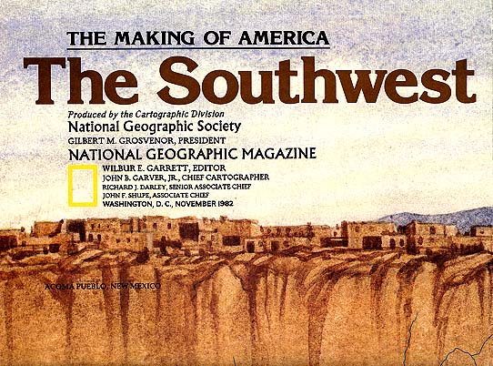
DEC. 1982 DMS THE MEDITERRANEAN SEA 1983 FEB. 1983 DMS ARCTIC & IT'S PEOPLES MAR. 1983 SUP 2) MAKING OF AMERICA - ATLANTIC GATEWAYS JUNE 1983 SDS THE UNIVERSE AUG. 1983 SUP 3) MAKING OF AMERICA - DEEP SOUTH NOV. 1983 SUP 4) MAKING OF AMERICA - HAWAII DEC. 1983 HMS EUROPE 1984 JAN. 1984 SUP 5) MAKING OF AMERICA - ALASKA APR. 1984 SUP 6) MAKING OF AMERICA - FAR WEST JUNE 1984 SDM JAPAN & IT'S HISTORY AUG. 1984 SUP 7) MAKING OF AMERICA - CENTRAL ROCKIES OCT. 1984 MAP TRAVELERS MAP - SPAIN & PORTUGAL DEC. 1984 DMS PEOPLE OF SOUTHERN ASIA 1985 FEB. 1985 SUP *8) MAKING OF AMERICA - NORTHERN APPROACHES APR. 1985 MAP TRAVELERS MAP OF THE ALPS AUG. 1985 SUP EARTH'S CRUST SEP. 1985 SUP 9) MAKING OF AMERICA - CENTRAL PLAINS NOV. 1985 DMS CANADA & IT'S VACATIONLANDS DEC. 1985 SUP 10) MAKING OF AMERICA - OHIO VALLEY 1986 MAR. 1986 SUP 11) MAKING OF AMERICA-TEXAS APR. 1986 DMS CENTRAL AMERICA JULY 1986 MS THE PHILIPPINES AUG. 1986 SUP 12) MAKING OF AMERICA - PACIFIC N'WEST SEP. 1986 SUP SMELL SURVEY NOV. 1986 DMS COLUMBUS'S LANDFALL DEC. 1986 SUP 13) MAKING OF AMERICA - NORTHERN PLAINS 1987 FEB. 1987 SUP 14) MAKING OF AMERICA - NEW ENGLAND APR. 1987 DMS PINNIPEDS OF THE WORLD JULY 1987 SUP 15) MAKING OF AMERICA - GREAT LAKES SEP. 1987 DMS USA & IT'S GROWTH NOV. 1987 SUP 16) MAKING OF AMERICA - WEST INDIES 1988 FEB. 1988 SDS AUSTRALIA JUNE 1988 SUP 17) MAKING OF AMERICA - TIDEWATERS NOV. 1988 DMS EVEREST & THE HIMALAYAS DEC. 1988 DMS WORLD / ENDANGERED EARTH 1989 FEB. 1989 SDM YELLOWSTONE & GRAND TEATON PARKS JUNE 1989 DS DINOSAURS AND OTHER EXTINCTS JULY 1989 DMS FRANCE - EVOLUTION OF A NATION OCT. 1989 DMS LAND OF MAYA - ANCIENT MAYA WORLD NOV. 1989 DMS ASIA - PACIFIC & WESTERN RIM DEC. 1989 SM HOLY LAND 1990 JAN. 1990 DMS ATLANTIC & ARCTIC MAR. 1990 DMS SOVIET UNION AUG. 1990 SDS THE SOLAR SYSTEM SEPT 1990 SM NEW (SPECIAL PLACES OF THE WORLD) DEC. 1990 DMS AFRICA THREATENED 1991 FEB. 1991 DMS MIDDLE EAST STATES IN TURMOIL MAR. 1991 SMS THE MAKING OF CANADA - QUEBEC JULY 1991 DMS CHINA SEPT 1991 DMS GERMANY - A TRAVELERS MAP OCT. 1991 DMS NATIVE AMERICAN HERITAGE DEC. 1991 DMS WWII EUROPE & AFRICA 1992 FEB. 1992 DMS SPAIN IN THE AMERICAS APRIL 1992 SMS THE MAKING OF CANADA- BRITISH COLUMBIA JUNE 1992 DMS PACIFIC AND INDIAN OCEAN FLOORS AUG. 1992 DMS SOUTH AMERICA - AMAZONIA OCT. 1992 DMS SOUTHWEST U.S.A. DEC. 1992 DMS THE NEW EUROPE 1993 JAN. 1993 DS N. AMER. IN THE AGE OF DINOSAURS MAR. 1993 DMS FORMER RUSSIA JUL. 1993 DMS COSTAL CALIFORNIA OCT. 1993 DMS ATLANTIC CANADA NOV. 1993 DMS WATER (SUPP. EXTRA) 1994 FEB. 1994 DMS THE WORLD MAY 1994 DMS ALASKA JUL. 1994 DMS MEGALOPOLIS - BOSTON TO WASHINGTON 1994 & 1830 SEPT 1994 DMS MEXICO - A TRAVELERS MAP DEC. 1994 DMS PRAIRIE PROVINCES 1995 JAN. 1995 DMS THE NILE FEB. 1995 DMS ITALY - HISTORIC APRIL 1995 DMS THE EARTH’S FRACTURED SURFACE JULY 1995 DMS HEART OF THE ROCKIES SEPT 1995 DMS REDISCOVERING HAWAII DEC. 1995 DMS ORION NEBULA - STAR BIRTH in the 1996 FEB. 1996 DMS INDONESIA APRIL 1996 DMS JERUSALEM THE OLD CITY JUNE 1996 DMS ONTARIO OCT. 1996 DMS FEDERAL LANDS DEC. 1996 DMS THE MONGOLS 1997 FEB. 1997 DMS DAWN OF HUMANS MAY 1997 DMS SOUTH ASIA - AFGHAN - MYANMAR JULY 1997 DMS THE ROMANS SEPT.1997 DMS THE NORTH – The Making of Canada DEC. 1997 DMS THE MESOAMERICANS 1998 FEB. 1998 DMS MILLENNIUM IN MAPS – EXPLORATION MAY 1998 DMS MILLENNIUM IN MAPS – PHYSICAL EARTH JULY 1998 DMS NATURAL HAZARDS OF NORTH AMERICA OCT. 1998 DMS MILLENNIUM IN MAPS – POPULATION DEC. 1998 DMS SPAIN and PORTUGAL – A Travelers Map 1999 FEB. 1999 DMS MILLENNIUM IN MAPS – BIODIVERSITY MAY 1999 DMS CASPIAN SEA AUG. 1999 DMS MILLENNIUM IN MAPS – CULTURES OCT. 1999 DMS MILLENNIUM IN MAPS – UNIVERSE/MILKY WAY DEC. 1999 DMS THE GREEKS 2000 FEB. 2000 DMS THE BALKANS JUNE 2000 DMS BRITIAN AND
JULY 2000 DMS AUG. 2000 STO SYDNEY OLYMPICS (Special Tear Out – don’t tear out this “fold out”) SEP. 2000 DMS WESTERN MIGRATION
DEC. 2000 DMS PEOPLING OF
THE 2001 FEB. 2001 DMS MARS REVEALED APRIL 2001 DMS THE EGYPTIANS JULY 2001 DMS SUNKEN TREASURES
SEPT. 2001 DMS DEC. 2001 DMS AFGHANISTAN – LAND IN CRISIS 2002 FEB. 2002 DMS ANTARCTICA MAY 2002 DMS THE INCA JUNE 2002 EVEREST SEPT 2002 THE STSTE OF THE PLANET OCT 2002 THE MIDDLE EAST 2003
MAR 2003 MAY 2003 EVEREST
JULY 2003 THE TWO DEC 2003 FLIGHT 2004 APRIL 2004 BIRD MIGRATIONS JULY 2004 THE SUN SEPT AMERICAN INDIANS NOV 2004 THE WORLD 2005 APRIL 2005 CIVIL WAR
JUNE 2005
SEPT 2005 DEC 2005 SEA MONSTERS 2006 APRIL 2006 EARTHQUAKES JUNE 2006 SOCCER OCT 2006 UNITED STATES DEC 2006 SOLAR SYSTEM 2007
MAY 2007
AUG. 2007 OCT. 2007 CLIMATE CHANGE DEC. 2007 DINOSAURS 2008
MAY 2008
AUG. 2008 PERSIAN EMPIRE
-
DEC. 2008 2009 APRIL 2009 SOLUTIONS - for a better world MAY 2009 ARTIC OCEAN
JULY 2009 KHMER
EMPIRE - 2010 APRIL 2010 WATER OCT. 2010 GULF OIL SPILL NOV. 2010 ANIMAL MIGRATIONS 2011 MAR. 2011 SEVEN BILLION
NOV. 2011 2012 MAY 2012 CIVIL WAR SEPT. 2012 OCEANS 2013 OCT 125th Anniversary ? 2014 APRIL UNIVERSE
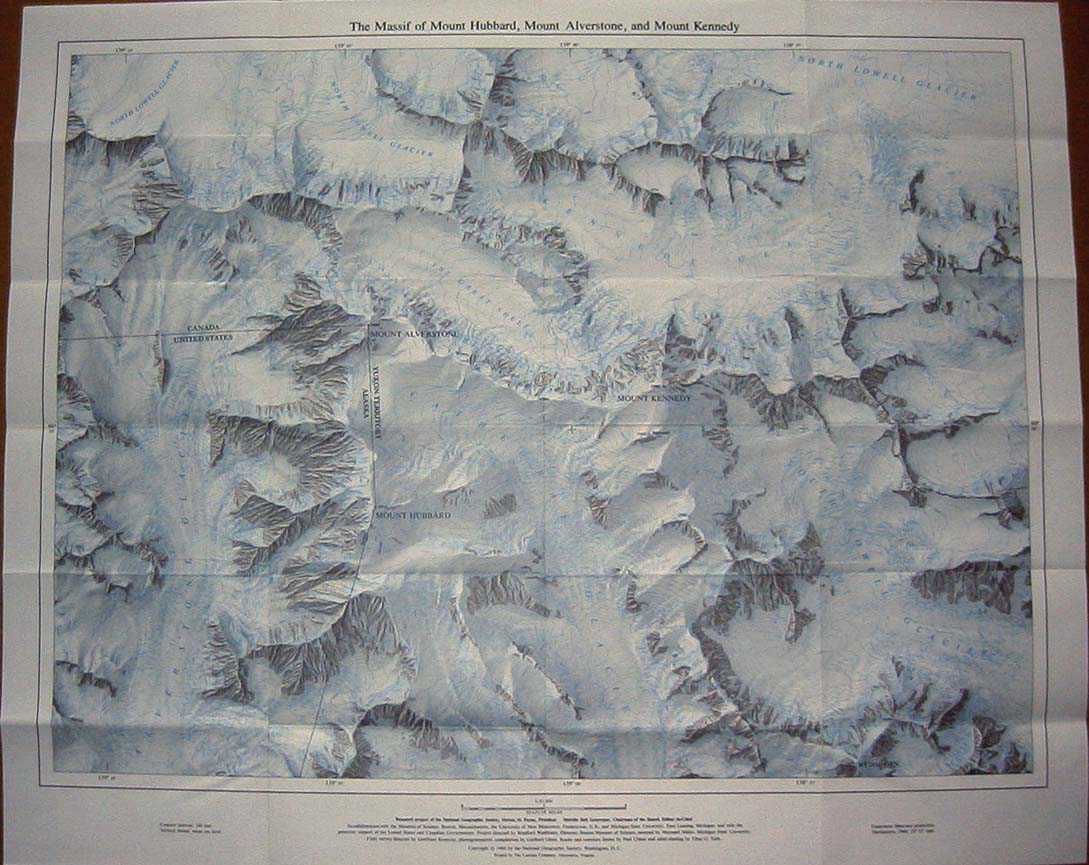
VARIOUS MAPS HAVE BEEN AVAILABLE ON ORDER OR FROM EXPLORERS HALL: Notable are Rolled Linen Maps prior to 1952.... Enlarged Maps after 1949, and: Maps not in Magazines: Union of Soviet Socialist Republics, 1960... 42" x 29 1/2" (Advertised in the December 1960 magazine pp 887, 888.) Northeastern Africa, 1966... 19" x 25" Physical Map of the World, 1964... 42 1/2" x 29 1/2"
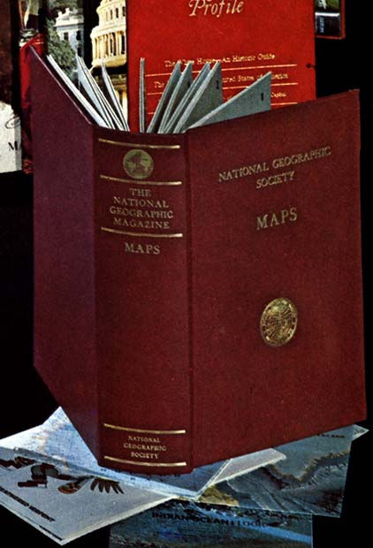
The Heart of the Grand Canyon, 1978... 35" x 36" Round About the Nations Capitol & A Tourist Map of Washington, 1976... 22 1/2" x 32" The following two supplemental maps were made available with extra notes and slightly larger at Explorers Hall: JULY 1964 GREATER NEW YORK, TOURIST MANHATTAN DEC. 1964 SUBURBAN and TOURIST WASHINGTON Map Slip Cases (shown as the border on the left and below) were made available during WWII and into the 60's. Most were generic with pockets for maps... two sets were made and sold with the Titles: Western and Eastern Hemisphere which included appropriate maps and indexes of the 30's and 40's in each.
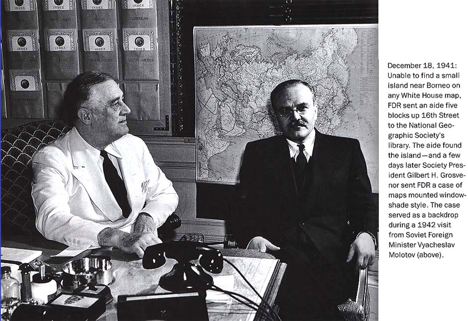
Map wall cases like the one behind FDR in the picture above were also presented as a public service to both Eisenhower and Truman at different times. Eisenhower wore out the NGS maps he used for early WWII planning and got a wall set. (see below) Truman had a wall case installed on his Yacht. That case was made available from a private party for sale in 1998 for (hinted price) above $3000. Cases like these were for sale to members from the 60's to the 80's with Indexes on one side, rolled maps on pull downs on the right.
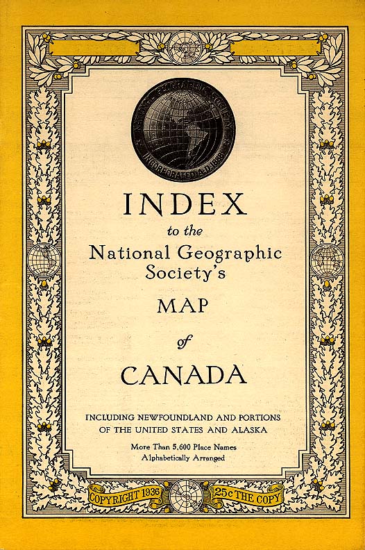
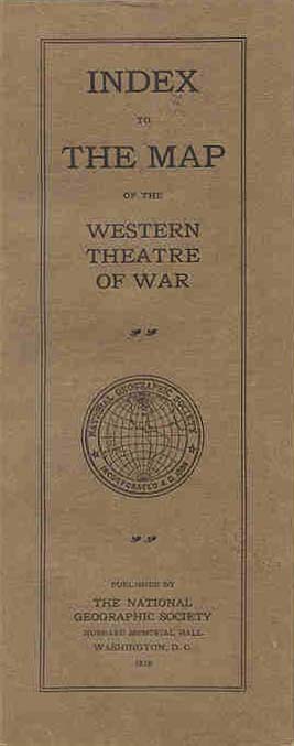
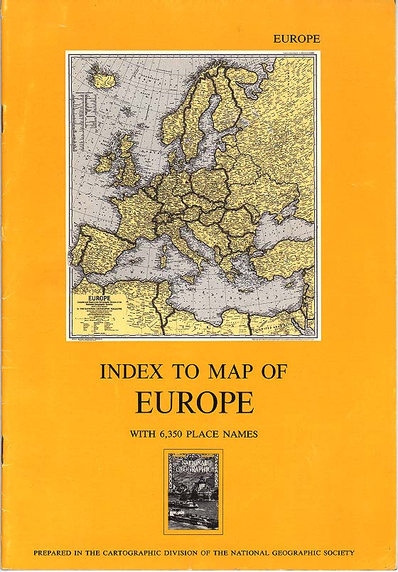
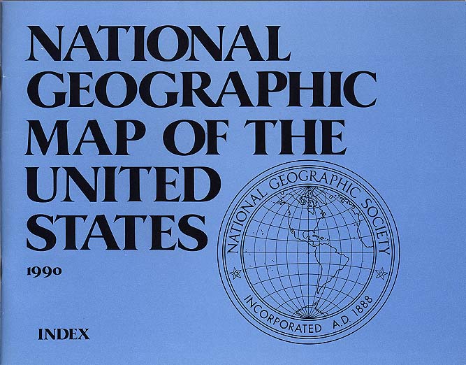
Some Map Index Types: Go Back To Top
Return to Link Page Click on Pics to enlarge Go Back To Top RETURN TO NG COLLECTORS CENTER
|


